ROAD AND INFRASTRUCTURE
Survey the road without closing it
Half a day of surveying - done in minutes.
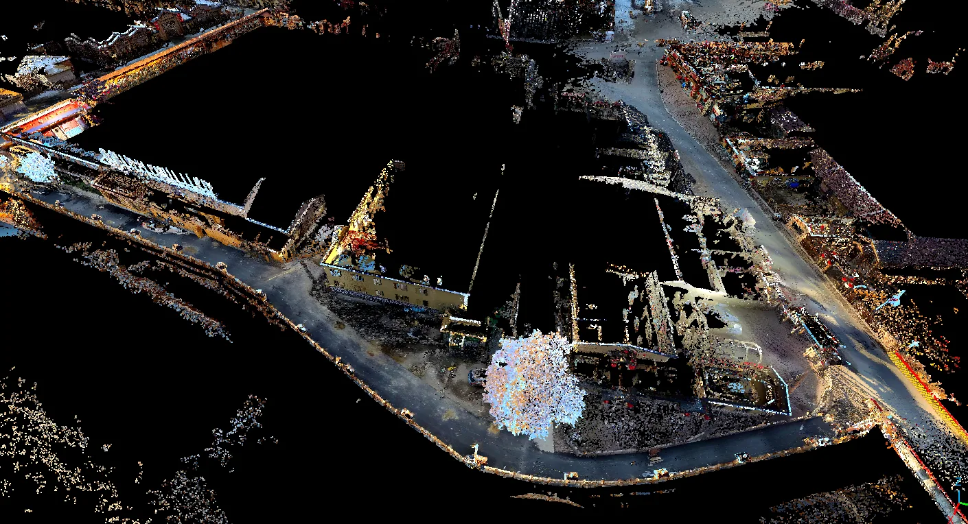
Drive, walk or carry the scanner along the road and get a complete 3D model with coordinates: pavement, kerbs, signs, lighting and surroundings in one pass - no lane closures, no staff in live traffic.
What traditional road surveying costs
FJDynamics own figures on the method that scanning replaces - the reason road authorities across the world are moving to LiDAR.
of the maintenance budget
is consumed by manual surveying, according to FJDynamics.
of lane closure per kilometre
is what manual surveying requires - scanning needs none.
higher accident rate
in road surveying than in construction generally; night work raises it further.
Figures from FJDynamics Road Survey solution documentation.
From drive-through to drawing
Three ways to cover the road
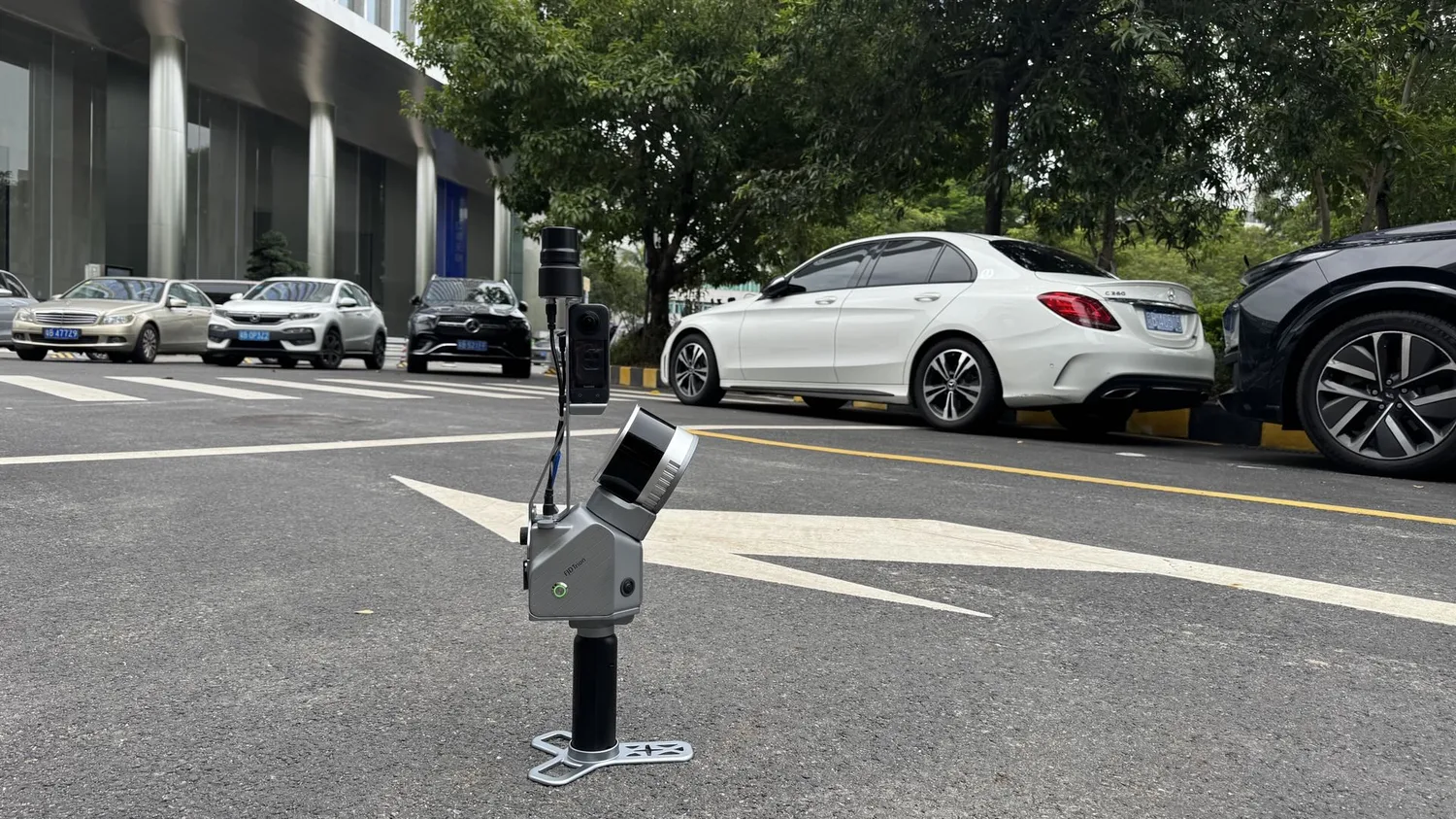
Municipal roads are scanned vehicle-mounted at 15-20 km/h. Campus and park roads are covered with the backpack. Alleys and footpaths are done handheld - 500 metres of street in about 15 minutes.
Drawings and quantities straight out of the scan
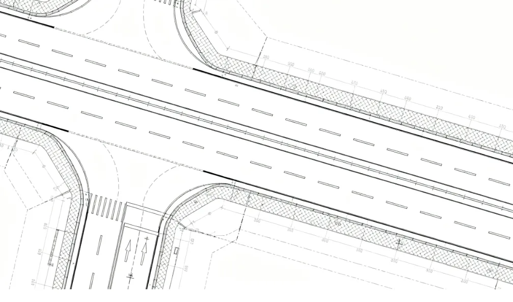
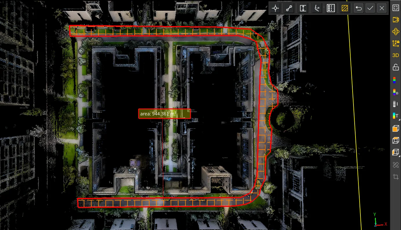
The point cloud becomes CAD drawings for planning and reconstruction, and pavement areas are measured directly in the model - length, width and area for material calculations.
Measure anything, afterwards
Because the whole road environment is captured, new measurements can be taken from the desk months later - without going back out. Cross-sections, slopes, clearances and volumes all come from the same model.
Case: a 720-degree spiral bridge in 17 minutes
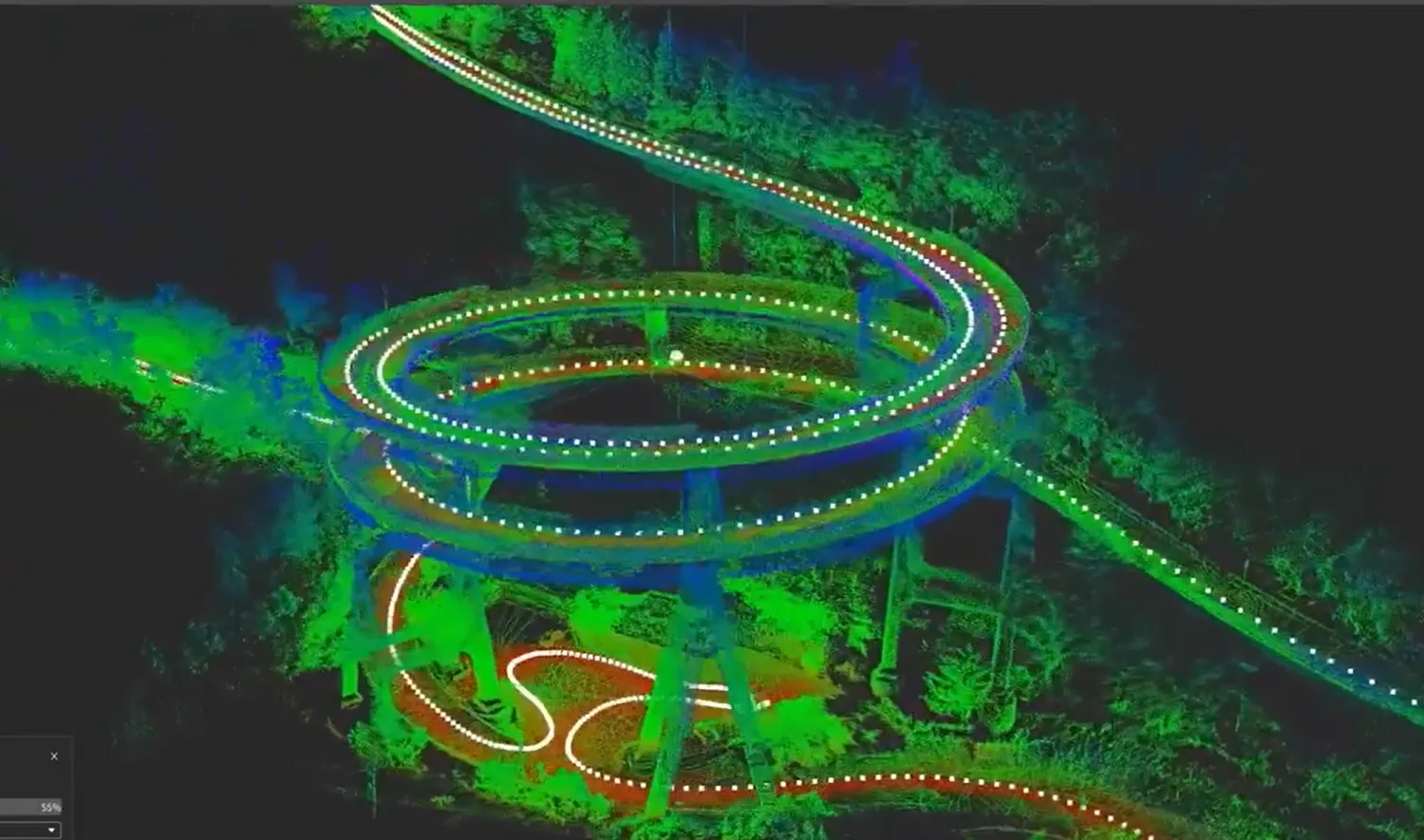
FJDynamics scanned Japan's Kawazu Nanadaru double spiral bridge vehicle-mounted. Curves, slopes and surrounding vegetation were captured with an 82.6% RTK fixed rate, and it took 17 minutes from field collection to a finished 3D model - data that went to the authorities for the reconstruction work.
Verified accuracy on real roads
FJDynamics verified the method against ground control points on two stretches - a 2 km road through dense buildings with moderate GNSS conditions, and a 3.5 km open road including a railway viaduct. Elevation accuracy came out at RMS 0.021 m and 0.040 m, plane accuracy below RMS 0.05 m.
Suitable for road cross-sections, urban GIS and road surveying - FJDynamics own conclusion from the verification.
How a road survey runs
1. Scope
We agree the stretch, what has to be captured and which deliverables you need - drawings, quantities or a full model.
2. Scanning
Vehicle-mounted, backpack or handheld depending on the environment. Traffic keeps running.
3. Processing
SLAM, RTK and panoramic images are fused into a coordinate-correct, colorized point cloud in FJD Trion Model.
4. Delivery
CAD drawings, cross-sections, area and volume reports, LAS point clouds - into your own CAD, BIM or GIS.
FJD Trion S2FJD Trion P2FJD Trion V100FFJD Trion V4e ProFJD Trion Model
Frequently asked questions
Do we have to close the road?
No. Vehicle-mounted scanning runs at 15-20 km/h in normal traffic, and handheld or backpack scanning is done walking. That is the single biggest difference from total station surveying.
How accurate is it?
In FJDynamics verification against control points: elevation RMS 0.021-0.040 m and plane RMS below 0.05 m on 2 km and 3.5 km stretches.
Can we get CAD drawings out of it?
Yes - FJD Trion Model generates road drawings from the point cloud, and the files open in Autodesk CAD and other standard software.
What about narrow streets and old town centres?
That is where handheld scanning shines: 500 metres of street in around 15 minutes, including everything the vehicle cannot reach.
Does it work where GPS is poor?
Yes. SLAM carries the positioning between satellite fixes - under viaducts, between tall buildings and among trees. RTK is added where real coordinates matter. For the toughest GNSS-free stretches - long tunnels, culverts and mines - FJD Trion V100F holds centimetre accuracy for more than 10 minutes with no satellite signal at all.
Can you do the scanning for us?
Yes. RoboService both sells the equipment and takes on scanning assignments - contact us with the stretch and we will propose a setup.
Put your next road project on real data
RoboService is an authorised FJD Trion dealer in Sweden. We demo the scanners, take on scanning assignments and support the whole workflow in Swedish.