THE FJD MIND PLATFORM - FORESTRY
FJD ForestMind
From measuring tape to model.
Walk through the stand with a handheld scanner. ForestMind segments every single tree out of the point cloud and delivers diameter, height, crown width and position - and from there timber volume and carbon storage.

Traditional forest inventory eats days
Diameter tapes and calipers mean contact measurement: several people in the field, heavy equipment and a lot of time - and the result is still a sample, not the whole stand. ForestMind replaces the tape with a scan you walk through once.
Time for the same plot
In FJDynamics own test, a plot that took eight hours to measure manually was handled in two hours with scanning and software.
Average diameter error
126 trees measured both manually and with the P2 scanner: average DBH error 9 mm, median 7 mm.
Trees in 35 minutes
A forestry team scanned 1,475 trees in two passes in 35 minutes with the Trion P1 - centimetre-level point clouds.
Figures from FJDynamics own tests and reference projects.
What ForestMind does with the scan
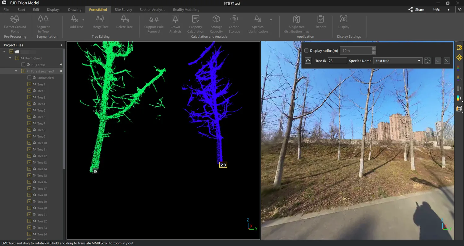
Every tree becomes its own record
The software separates ground from vegetation, then segments individual trees out of the point cloud and calculates coordinates, height, DBH, crown width and volume per tree. Attached support poles are removed automatically so the trunk data stays clean.
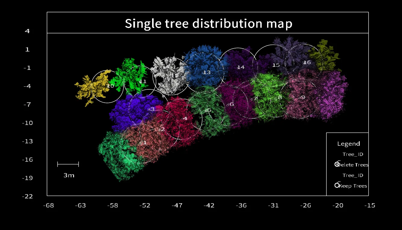
A map with every stem on it
Tree positions are extracted into a standardised distribution map where each stem is labelled with its coordinates - and the whole stand can be exported as a report for planning, valuation or documentation.
AI suggests the species
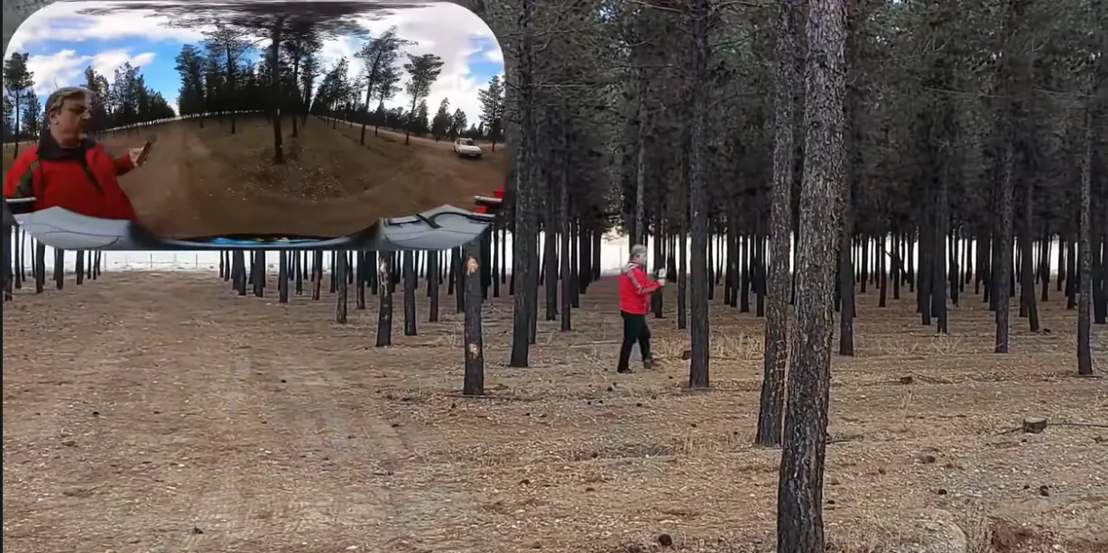
Using the structure of the point cloud together with the camera images, the software distinguishes species automatically - and where the segmentation gets it wrong, you correct it by hand in the editor.
Documented forest data - not estimates
Requirements on traceable forest data are tightening, not least through the EU deforestation regulation (EUDR), which FJDynamics themselves name as a driver behind ForestMind. A scanned stand gives measured values with coordinates on every tree - documentation that holds up in an audit, a valuation or a sale.
Carbon storage and timber volume are calculated from the same scan - the two figures most often requested on top of the basic inventory.
How a survey runs
1. Preparation
Confirm the boundaries of the survey area and plan the walking route through the terrain and vegetation.
2. Scanning
Walk the stand with a Trion P1, P2 or S2. The point cloud builds in real time - no GNSS required under canopy.
3. Processing
The raw data goes into FJD Trion Model, which extracts ground points, segments the trees and calculates the parameters.
4. Delivery
Reports, tree maps, LAS point clouds and panoramas - into your own forest management system or as documents.
Where ForestMind is already in use
FJDynamics runs forestry research collaborations with the University of Tokyo and Oregon State University, and has delivered scanners to Romanian government agencies for forest inventory. The method is also combined with drones - airborne LiDAR from above, handheld scanning from the ground, merged into one model.
Reference projects are FJDynamics own. ForestMind is not yet released on the Swedish market - contact us and we will tell you as soon as it is.
Frequently asked questions
What do I actually get per tree?
Position, height, diameter at breast height, crown width and volume - plus species where the AI can determine it. The whole stand is compiled into a report and a tree map.
How accurate is it compared with a caliper?
In FJDynamics own test of 126 trees the average diameter error was 9 mm and the median 7 mm - close enough for inventory and valuation work.
Does it work under dense canopy without GPS?
Yes. The scanners position themselves with SLAM, so the point cloud builds even where the satellite signal is gone. GNSS is added when the result needs real coordinates.
Which scanner should we use?
The P2 is the light all-day option, the S2 reaches further in open stands, and the P1 is the compact one. We match the scanner to your stand types.
Can the data go into our existing system?
Yes - LAS point clouds, panoramas and 3D models are standard formats that import into forest management platforms and GIS.
Can we buy this today?
The scanners and Trion Model are available from us now. ForestMind as a platform is not yet released in Sweden - get in touch and we will keep you posted, and meanwhile show what the current software already delivers.
Want to see it on your own stand?
RoboService is an authorised FJD Trion dealer in Sweden. We demo the scanners, show what the software delivers on real forest data and support you in Swedish.