
The CHCNAV AA6 and the CHCNAV AA6D are airborne LiDAR systems for drones: a laser scanner, a positioning system and a camera in one unit. They share the same laser, so the real choice is between a single high-resolution camera and two wide-angle cameras, and between less weight and a wider view. This guide goes through what is the same, what differs and which one fits which job, using CHCNAV's own figures.
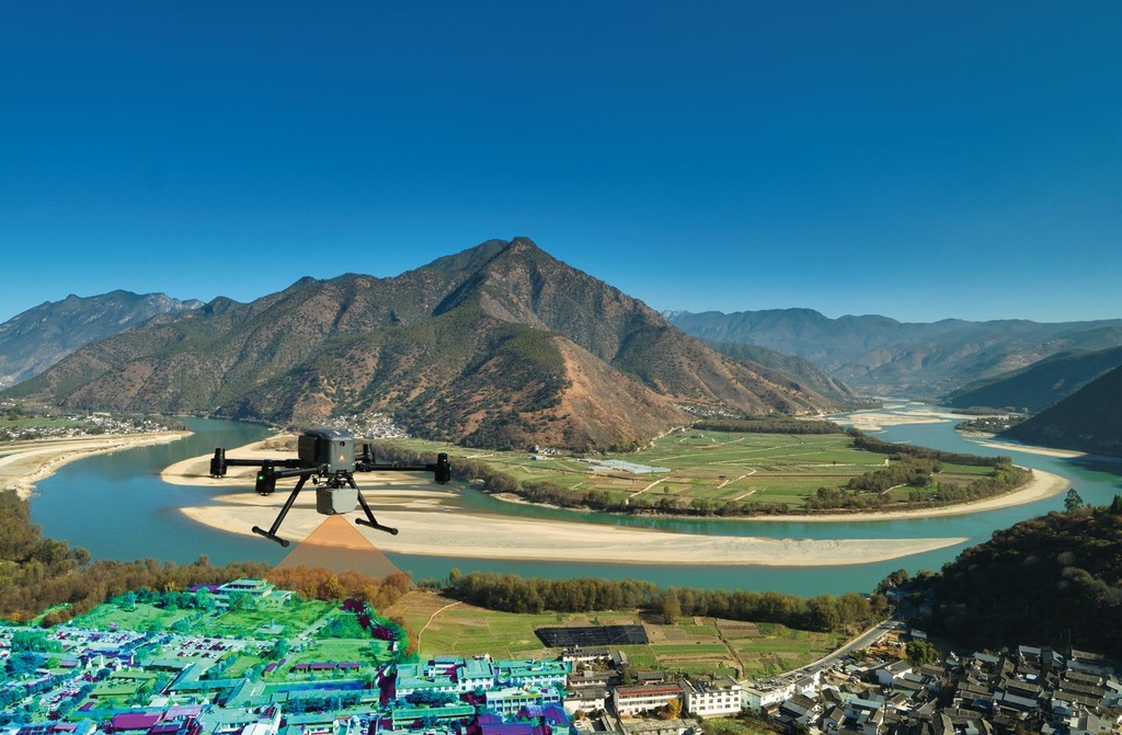
What the system does
The laser sends out pulses and measures how long each takes to return. Together with a high-grade inertial unit and satellite positioning, that gives every point a position in space. The result is a point cloud of the terrain, buildings and vegetation. Because the laser can register several returns from one pulse, part of the signal can reach the ground through foliage. Both systems record up to 16 returns per pulse, and an integrated camera takes pictures during the same flight.
What the data looks like
Below is a real dataset from a flight with the CHCNAV AA6 over Tegelberga golf course outside Svedala, on a course with fairways, rough, bunkers, greens, ponds, buildings and paths, processed in CHCNAV's CoCloud. CoCloud's own overview lists about 12.5 GB of raw scanner data and, from it, a point cloud of 25.3 GB, a textured 3D model, a height model and an orthomosaic.
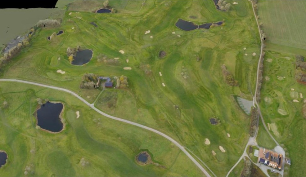
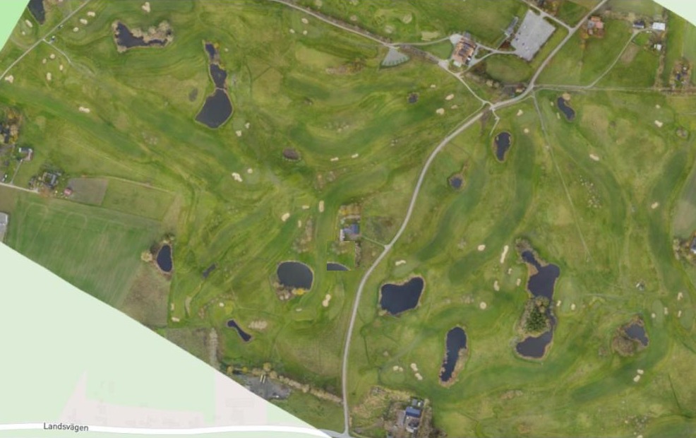
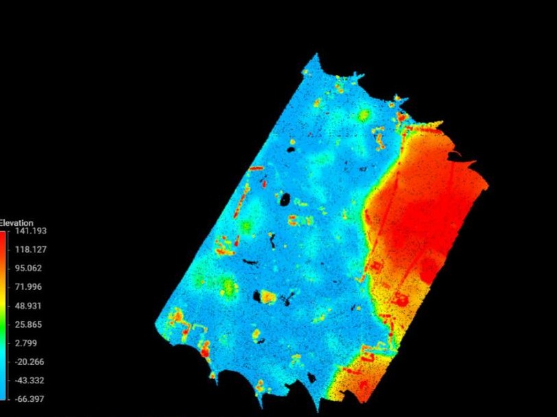
From one survey you get several outputs that answer different questions:
- Point cloud: a very large number of measured points, each with a position and a colour. In this dataset the points are also split into ground points and everything else.
- 3D model: a textured model you can look at from any angle.
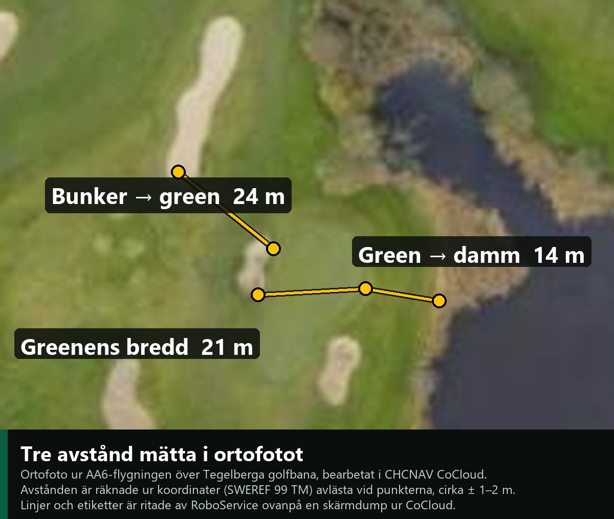
- Orthomosaic: an aerial image corrected so that distances and areas can be measured in it.
- Height model (DEM): the shape of the ground as a surface.
- Intensity: how strongly each laser pulse returned, which often reveals differences between surfaces such as water, fairway, rough, sand and gravel.
What can you use a survey like this for?
- Terrain and drainage. The height model shows where water runs and collects, which helps with drainage, ditching and wet spots.
- Volumes and earthworks. Compare two surveys of the same area to calculate how much material has been added or removed, for example sand in bunkers or fill in a rebuild.
- Planning and design. Lay a design drawing over the real ground before you build. CoCloud has a design overlay function for this.
- Inventory and condition. Map fairways, rough, greens, bunkers, ponds, paths, trees and buildings, and follow how they change from season to season.
- Ground beneath vegetation. Because the laser records several returns from one pulse, part of the signal can reach the ground through foliage, which helps map terrain under trees and scrub.
- Maintenance planning. Exact areas and shapes are a base for planning work such as mowing and maintenance zones for fairway, rough and green.
- Documentation. A dated, measurable record of how an area looked, useful for handover and follow-up.
Teaching machines and robots the areas
A survey like this is not only for people to look at. It is also a way to tell machines and robots what the ground consists of. Once the areas are measured and named, such as fairway, rough, green, bunker, pond and path, they can be turned into a digital map that a robot or a machine can work from.
- Mowing. Areas with different needs can be given different treatment, for example fairway and rough, while the green, the bunkers and the ponds are marked as places to keep out of or to handle separately.
- Spraying. A measured map can be used to mark which parts should be sprayed and which should not, so that the product goes where it is meant to go and nowhere else.
- Zones and boundaries. Paths, water and buildings can be marked as areas a machine must not enter.
In short, a survey lets us communicate with robots and digital technology in a way they understand. We see our reality, and they see their digital reality. The survey is what connects the two. How a given robot or machine takes in such a map depends on the system, so check what formats and functions yours supports.
The same method is used on construction sites, roads, quarries, forestry and along power lines. How accurate a result is depends on the setup: flight height, RTK, any ground control points and the processing. The accuracy figures in this guide are CHCNAV's typical values at stated heights; for survey-grade work, check the result against known control points.
What is the same
According to CHCNAV the two share the laser, the positioning and the housing class. The figures below are CHCNAV's typical values; the datasheet figures come from our product pages and the range figures from CHCNAV's own pages.
| Both AA6 and AA6D | |
|---|---|
| Laser | 1535 nm, class 3R (IEC 60825-1:2014) |
| Range | 2,100 m at over 80 % reflectivity; 960 m at 10 % (CHCNAV's product pages) |
| Point rate | up to 2,000,000 points per second |
| Returns | up to 16 |
| Laser field of view | 90°, prism scanning |
| Typical flight height | 100–600 m above ground |
| Point density | 220 points/m² at 120 m (1,000,000 points/s); 13 points/m² at 400 m (200,000 points/s) |
| System accuracy (RMSE) | 3 cm vertical and 3 cm horizontal at 120 m above ground; 5 cm vertical and 6 cm horizontal at 300 m |
| Inertial unit | 500 Hz, 0.3°/h bias instability |
| Satellite systems | GPS, GLONASS, BeiDou and Galileo |
| Storage and copy speed | 512 GB, 200 MB/s |
| Protection and temperature | IP64, -20 to +50 °C |
What differs
| AA6 | AA6D | |
|---|---|---|
| Camera | One 4/3-inch CMOS | Two APS-C CMOS |
| Resolution | 25 MP or 100 MP, switchable | 2 × 26 MP |
| Camera field of view | 74° (12 mm) | 110° (16 mm) |
| Shortest trigger interval | 0.5 s at 25 MP, 1 s at 100 MP | 1 s |
| Weight | 1.35 kg | 1.85 kg |
| Dimensions | 155 × 120 × 129 mm | 223.5 × 120 × 129 mm |
| Power draw (typical / max) | 40 W / 46 W | 50 W / 60 W |
| Effective flight time on the X500 | up to 50 min | up to 40 min |
| Coverage per mission on the X500 | up to 15 km² | up to 15 km² |
The flight times and the coverage are CHCNAV's own figures for the X500 and depend on weather, wind and mission. CHCNAV also states that the AA6D's wider view needs only about 20 % side overlap and can raise operating efficiency by up to 30 % compared with the AA6. We have not verified that claim ourselves.
The camera: what really sets them apart
The laser is the same in both, so the difference is the camera, and what the camera costs in weight and flight time. Here is what the numbers mean.
- Sensor size. AA6 has one 4/3-inch CMOS sensor. AA6D has two APS-C CMOS sensors. According to CHCNAV an APS-C sensor is about 60 % larger than a 4/3-inch one. A larger sensor collects more light per pixel, which in general gives cleaner images in weak light and from higher altitude.
- Resolution. AA6 can shoot 25 MP or 100 MP. In 25 MP mode the pixels are larger, which CHCNAV says gives a better signal-to-noise ratio and less data, and suits flights below 150 m. In 100 MP mode you get finer detail, and the same ground resolution (GSD) from a higher altitude, which suits flights above 150 m, at the cost of more data. AA6D has two cameras of 26 MP each, in total about 52 MP per trigger (2 × 26), and no switch between modes. The 150 in CHCNAV's text is an altitude in metres, not a pixel count: the high-resolution mode on AA6 is 100 MP.
- Field of view. AA6 sees 74° (12 mm lens), AA6D 110° (16 mm). A wider view covers more ground in each pass, so the lines can lie further apart. CHCNAV says AA6D needs only about 20 % side overlap and can raise efficiency by up to 30 %; we have not verified that figure.
- What you give up. AA6D weighs 0.5 kg more (1.85 kg against 1.35 kg), and CHCNAV gives about ten minutes shorter flight time on the X500. AA6 can also trigger faster: every 0.5 s in 25 MP mode against every 1 s on AA6D.
So what do you gain with AA6D? Mainly two things: more ground covered per flight line, and larger sensors. That pays off on large, open areas where you want to fly as few lines as possible, and when light or altitude is difficult. It does not give a better point cloud, because the laser is the same. If weight, endurance or one very high-resolution image per trigger matters more, AA6 is the better choice.
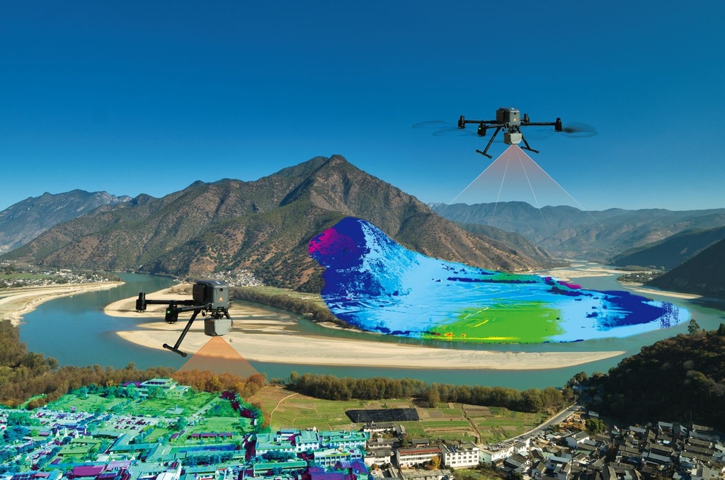
Which one to choose
- AA6 fits when weight and flight time matter, when you want one high-resolution image per trigger (up to 100 MP), or when the work is over steep, high-relief terrain, which CHCNAV highlights for this unit.
- AA6D fits when a wide view is worth more than weight: two cameras with a 110° field of view cover more ground per pass, at the cost of 0.5 kg more weight and, according to CHCNAV, about ten minutes less flight time on the X500.
- Because the laser is the same, the point cloud quality does not differ between the two. The choice is about the images and the airframe.
Which drone carries them
CHCNAV states that both are supported on the CHCNAV X500, and that open interfaces allow use on other multirotors, fixed-wing aircraft and manned aircraft. For how the X500 compares with DJI's Matrice 350 RTK and 400, and with their LiDAR options, see our buyer's guide to industrial drones.
Software and data
CHCNAV's CoPre handles pre-processing (positioning solution, adjustment and refinement, point cloud generation) and CoProcess handles point cloud processing. Both are optional software. Ask which software and which data formats your work needs before you decide, since that is often a bigger part of the day than the flying.
Safety
The datasheet states laser class 3R (IEC 60825-1:2014). For that class, do not look into the beam, and follow the manual for the unit. Check which permits and rules apply to your type of operation with Transportstyrelsen before you fly.
Questions to ask before you buy
- Which point density and accuracy does your deliverable require, and from which flight height?
- How much vegetation is there, and do you need the ground returns beneath it?
- Do you need the pictures for deliverables, or only the point cloud?
- Which software and data format does your client or your workflow expect?
AA6 and AA6D at RoboService
You will find the units on their product pages, CHCNAV AlphaAir 6 (AA6) and CHCNAV AlphaAir 6 Dual (AA6D), and as part of two X500 packages: X500 + AA6 LiDAR package and X500 + AA6D LiDAR package. Price on request – contact us and tell us what you want to map, and we will help you work out which unit fits.
Sources: CHCNAV AlphaAir 6 (AA6) · CHCNAV AlphaAir 6 Dual (AA6D) · CHCNAV AA6 · CHCNAV AA6D. Read 19 November 2026; the manufacturer may update its figures. Sample data processed in CHCNAV CoCloud; images are screenshots from its viewer.